What will La Niña mean for the Pacific Northwest mountain snowpack?

The Climate Prediction Center asserts: “La Niña is favored to emerge in September-November 2024 (60% chance) and is expected to persist through January-March 2025.” Like most things in life, the devil is in the details. So how do we answer the questions you’ve likely been daydreaming about? Are we really going to get a La Niña winter? What will that mean for our snowpack? We explore how the snowpack in our region responds to the 3-month moving average of Sea Surface Temperature (SST) anomalies in the middle of our winter season (also known as December-January-February or “DJF” anomalies).

Photo by Matt Patterson

The El Niño-Southern Oscillation (ENSO) is a period of fluctuation in SST and the air pressure of the overlying atmosphere across the equatorial Pacific Ocean. ENSO has three phases: El Niño, La Niña, and Neutral. The October 10th CPC forecast predicts the DJF anomaly this season will either be a 5% chance of a strong La Niña, 25% chance of a moderate La Niña, 41% chance of a weak La Niña, 29% chance of neutral conditions, or a 1% chance we enter weak El Niño conditions in early 2025. Quite a range of potential outcomes!

Before your mind wanders too far with all these possibilities, let’s compare the percentage of normal peak seasonal snow depth (inches) against the DJF anomaly strength (ENSO phase) using our snowpack climatology dataset.

Snowpack Climatology Dataset

A moderate La Niña tends to be quite favorable for snowfall along the west slopes and crest of the Cascades (>110% of normal). Peak snow depth is markedly lower for a weak La Niña, except at Mission Ridge, but remains near normal. The outcome tilts slightly more negative in an ENSO neutral phase where slightly below normal conditions are favored at all stations except Timberline. Well-below-average peak snow depths (76-84% of normal) would be anticipated should we tip into a weak El Niño by January (1% chance). Note that Mission Ridge (on the east slopes of the Cascades) has a weaker signal due to ENSO than the stations near or west of the Cascade Crest and therefore doesn’t follow the same trend. 

If we look specifically at an average of the four sites with the longest and most robust data records (Mt Baker, Stevens Pass, Snoqualmie Pass, and Paradise), we can see the scatter of the data. The graph below illustrates the relationship between DJF SST anomalies and peak snow depths averaged across these sites. For every 1°C increase in SST anomaly, peak snow depth decreases by 1 foot. This relationship is statistically significant, with a p-value of 0.0052, confirming that warmer winters (associated with El Niño) lead to lower snowpacks across the Pacific Northwest. If you recall the recent 2023-24 season (star on the plot below), it was a shallower peak snowpack than we would have anticipated from the ENSO regression trendline. 

If we zoom in a bit closer, we can see data in the range of possible outcomes for the 2024-25 winter:

All moderate and strong La Niña seasons in the dataset have peak snow depths greater than or equal to the mean for ENSO neutral. And all of these moderate and strong La Niña years exceed typical snow depth values of an El Niño year by 5% or more. All that to say, if the negative Sea Surface Temperature anomaly intensifies sufficiently, we’re in store for a great season!

Photo by Matt Patterson

Some less-than-stellar snowpack years start coming into the mix as we head into the most probable ENSO phases for the 2024-25 season–a weak or neutral La Niña–with little to no weighting on the dice. Some of the worst seasons in PNW history have occurred in a weak El Niño, so fingers crossed the Niño 3.4 region of the Pacific Ocean (where we measure ENSO SST anomalies)  doesn’t enter El Niño territory by January. Fortunately, the odds of that are very low! 

To summarize, the strength of an anticipated La Niña ENSO phase has a major influence on our chances for an above-average snow season in our forecast zones. A moderate La Niña or stronger gives us very high chances of normal to above normal peak snowpacks. Whereas a weak La Niña or ENSO neutral conditions give us a range of potential outcomes close to the overall average for our region.

So if you want to load the dice in favor of a cold, snowy winter in our mountains, root for strong upwelling of cold water off the coast of South America!

____________

Disclaimers:

  • The datasets are not fully quality-controlled.
  • The impact of long-term climatic changes has not been incorporated into this study, but preliminary analysis suggests that ENSO impacts remain larger than the overall climate trends.

In Memory of Matt Primomo

In the aftermath of the loss of beloved community members, we wanted to share some resources.

For those of you grieving, we’re with you. If you are hurting, reach out and talk to a friend. If you think someone in your life is struggling, check in with them. Family, friends, and community are everything. 

(more…)

2023 NWAC Updates: What’s new this year

Though the season has only just begun, behind the scenes at NWAC we’ve been working for months to roll out a number of big changes. Some of these projects have been underway for over a year, and all were made possible thanks to community support. To learn more about this season’s changes, including new staff, forecast process updates, observations, and an all-new app, read on!

(more…)

The Avy App

Download the app here: Apple | Android

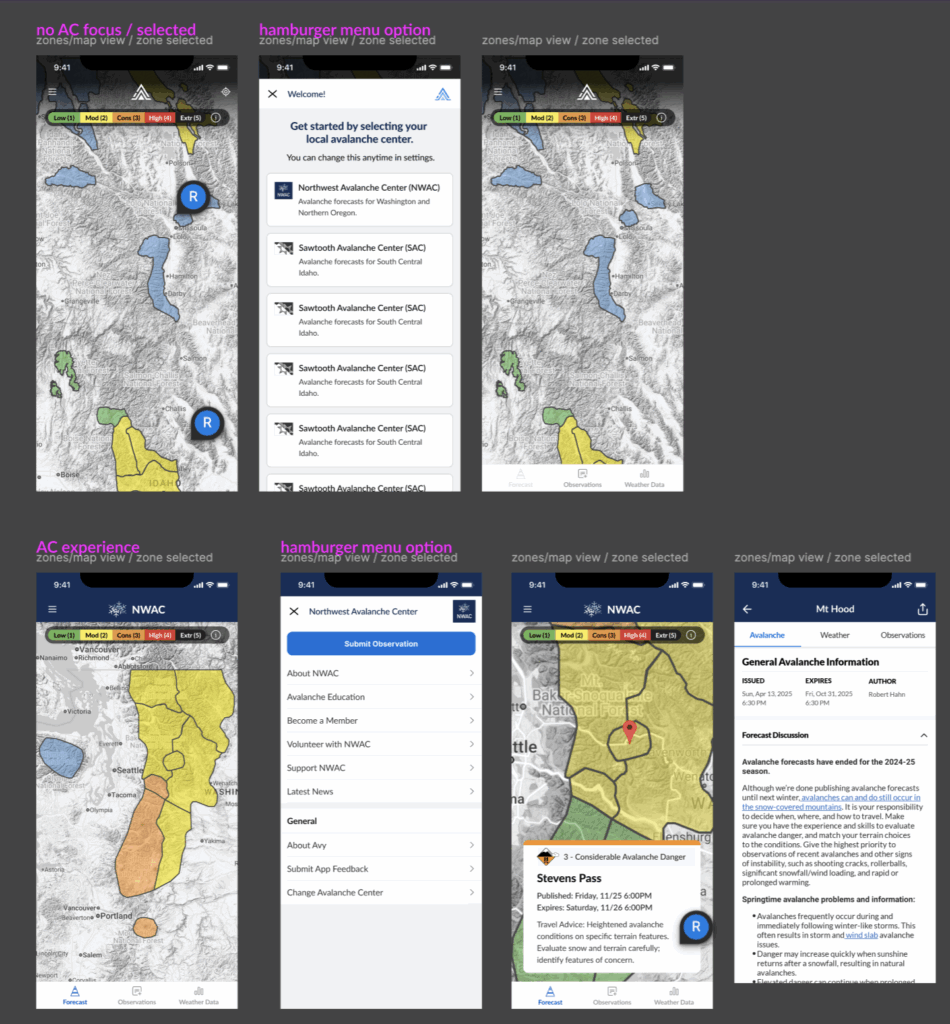
In late November 2023 NWAC launched a purpose built mobile app, Avy, that allows users to access weather and avalanche information for the Northwest Avalanche Center (NWAC) and the Sawtooth Avalanche Center (SAC). The app’s purpose is to provide a streamlined user experience for your core trip planning tools, including avalanche forecasts, weather forecasts, weather station data, and observations. Over the coming years, we hope to add the majority of avalanche centers across the country to the Avy app. 

Avy was funded 100% through individual giving to the Northwest Avalanche Center. We are grateful to be part of a community that allows us to make ambitious projects like this happen!

(more…)

Gear Up for Winter: Tips for Maintaining & Repairing Your Winter Outerwear

At NWAC, we know the stoke caused by the season’s first snowfall and the anticipation of heading to the slopes or venturing into the backcountry. As you prepare for your next winter adventure, it’s important to address a commonly overlooked aspect: gear maintenance. For this blog post, we’ve invited local PNW-based company GEAR AID to explain why gear care and repair matters when getting ready for the winter season.

(more…)

Building a New Type of Weather Station

The NWAC mountain weather station network is the largest of its kind, and this fall we were able to expand our network even further. Adding a new weather station to the mix requires months (and sometimes years) of planning with a number of stakeholders, and requires significant time and financial investment. It is thanks to the support from our community that we were not only able to purchase the equipment but also increase the staff hours needed over the off-season. These resources allowed us to take on building a weather station unique from all others in our network.  

Maintaining and expanding our network of weather stations is key to our forecasting. “NWAC’s automated weather stations are the observations that keep on giving. When access to the mountains is difficult for us and our partners, the weather stations are there to at least give us some idea of what is unfolding,” said Avalanche Forecaster Andy Harrington. More stations mean better insights into what is happening in the mountains 24 hours a day. 

(more…)

Recreate Like a Pro

For the vast majority of us enjoying days out in the snowy mountains is a hobby, albeit a sometimes all consuming one. So when planning for and executing your trip plans, you may not be approaching it from the lens of systemic rigor that those paid to work as snow and avalanche professionals do. But if you aspire to big days in the mountains, finding the best snow, and reducing risk while gaining reward, it’s worth looking at some of the big-picture practices that avalanche workers, ski guides, and other mountain professionals bring to the table on a daily basis.

(more…)

NWAC’s Short Film: The Bottom Line

We made a movie! The Bottom Line is NWAC’s first short film and tells the story of what it takes to create an avalanche forecast. Avalanche forecasters Irene Henninger, Lee Lazzara, and Matt Primomo take you along starting in the field and ending at the computer synthesizing information into the avalanche forecast.

Click here to watch

Director: Nick Meilleur

Producer: Molly Scudder

NWAC Forecasters: Irene Henninger, Lee Lazzara, Matt Primomo

Additional footage: Tommy Yacoe

P.S. Can you spot any places you like to ride in the video?

NWAC’s Weather Station Network

By Andy Harrington

Did you know that NWAC manages the largest automated weather station network of any avalanche institution in the United States?

These stations are located throughout our forecast zones, providing tabular and graphical weather and snowpack information to not only avalanche professionals, but to our entire community. Snow depth, precipitation, temperature, wind speed, and wind direction are the core measurements recorded. Other measurements are available depending on the station. Currently there are 50 stations in the NWAC network; 13 of these stations are managed and owned by WSDOT. Many of these stations date back to prehistoric times when phone lines and paper chart recorders roamed the earth. We have worked hard in recent years to upgrade our network and nowadays, you will find cell modems, radio relays, and fast ethernet connections delivering us almost real-time data about what is happening in the mountains.

(more…)