Observation: Public
Observation Details
Name:
Enji CooperObservation Date:
December 17, 2022Submitted:
December 17, 2022Zone or Region:
West SouthActivity:
XC Skiing/SnowshoeingLocation:
Christoff Lookout Site environsSigns of Unstable Snow
Observations
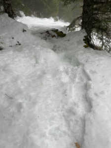
Today was a challenging day of travel up to Christoff Lookout Site.
Snow conditions were extremely variable.
Low elevations (<2.5k') were mostly trace (<4") below treeline and very consolidated in the morning. It turned into sloppy wet loose-ish conditions on the way down as the day progressed/got warmer. I booted this section (boot pen was 2"~4").
Getting above 2.5k' to the summit exhibited different conditions (qualitatively). Under tree cover the snow was a mixture of pencil hard crust in many areas (probably due to external precip from tree rain shadows). Roll the dice and either the snow would support our weight, or we'd break the crust and encounter the frozen/rounding grains. Out in the open though, the snow turned into Jersey cream-ish powder in the shade and had a melt/zipper crust in south facing sun exposed aspects. My guess is that there was less consolidation due to lack of external precip from trees or rain.
A couple quick pits at the summit showed a difference in terms of snowpack: the north-facing aspect pit was 110cm-115cm HS; the south-facing aspect pit was 85cm in one area (probe only) and 70cm where I dug (both south-facing samples were in sunnier areas, as was the north facing aspect). By and large the south facing snowpack was more consolidated, but I made out a variety of supportive, mostly right-side up snowpack with fluffy powder on top, then a mix of wind fetch/storm snow on top of weak faceting grains. The interface of interest in the south pit was at 45 HS (powder on top of storm snow) and the layer near ground (it was ~1cm). The powder was weak (fist) and the storm snow was considerably stronger (4 finger+/1 finger).
The north pit's interface of interest was 80cm (fist+), with layers below 80cm HS being 4 finger strength. The layer above 80cm resembled wind fetch in terms of strength (fist) and was consolidated such that when I was digging, I got a small non-diffuse slab to come off.
I didn't do an ICT or ECT because it was so cold near the summit. The wind was blowing 10~15mph, which was chilling us down what I'd estimate to be the 20s.
Weather was mostly clear in the morning, but the prevailing west wind brought in a storm front, which resulted in S-2 snowfall down to Greenwater.
Wind fetch was being blown visibly off of Mt. Rainier near Liberty Cap (I qualitatively estimated the direction being a SW/W wind): the wind was definitely ripping at 13k'~14k'.
Media